
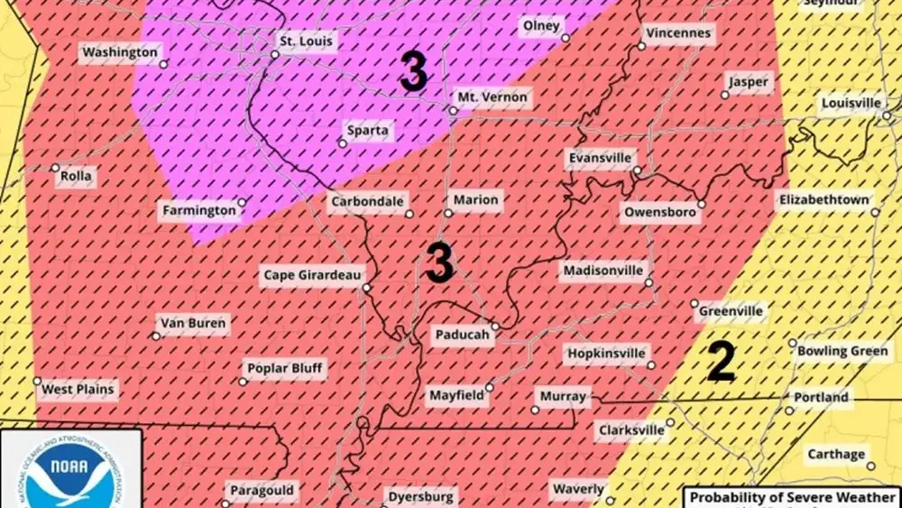
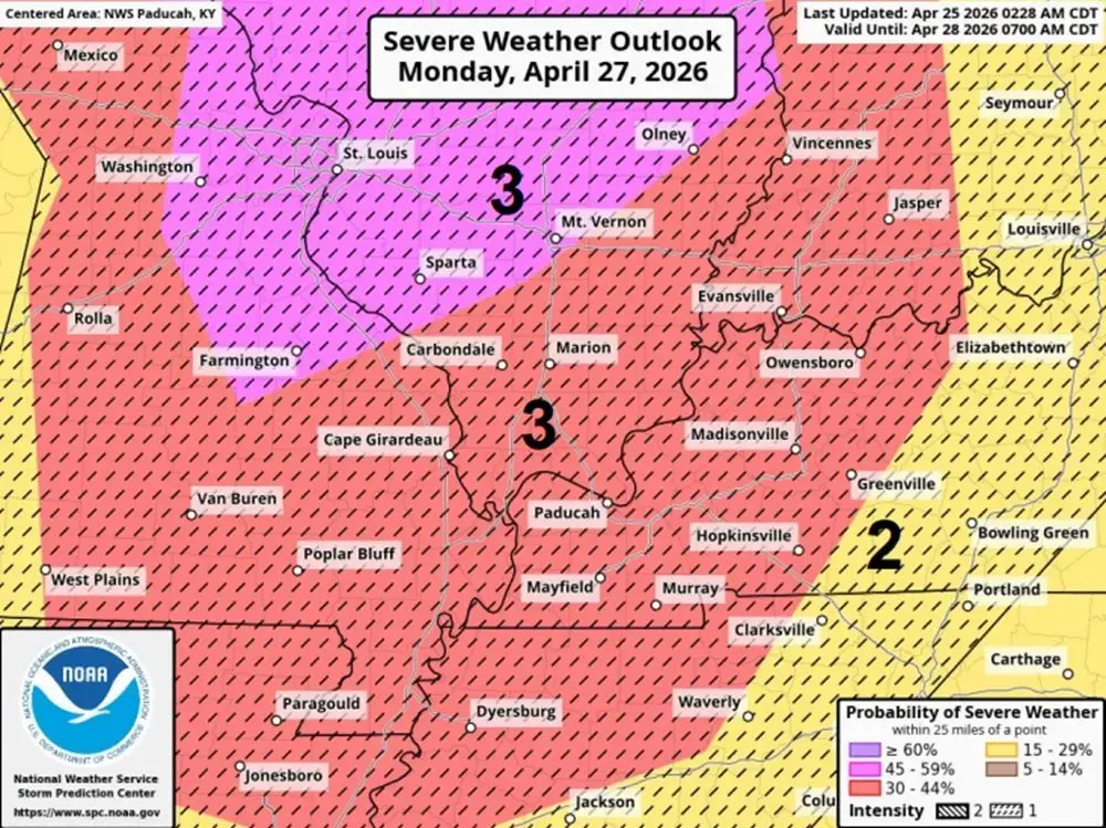
The National Weather Service in Paducah says the threat of a significant severe storm outbreak continues throughout the Quad State late Monday afternoon and Monday evening.
As of this Saturday morning, forecasters indicate the latest outlook from the Storm Prediction Center places much of the region under at least some level of severe weather risk for Monday, with the current forecast expanding the enhanced risk area to include the entire quad-state area. The enhanced risk area now includes Hopkinsville, Madisonville, and Greenville, with a slight risk of severe weather to the east of these areas.
Possible hazards include strong tornadoes, destructive straight-line winds, and very large hail — two inches or larger in diameter.
Forecasters are highlighting an unusually high level of agreement between weather models, which is often a red flag for a significant weather event. Unlike typical forecasts that might fluctuate, they indicate the data for this system remains remarkably stable. They say the shear is very favorable for tornadoes from supercells and squall lines.
Forecasters add that while the atmosphere is primed for activity, the specific details of when and where the storms will strike are still coming into focus, but the details should become clearer in the next 24 hours.