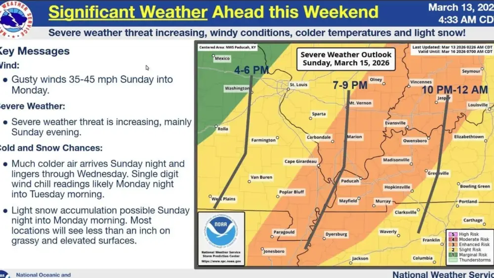
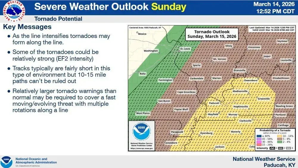
A line of severe storms is expected to develop along a cold front moving through the Pennyrile region on Sunday evening.
NWS Paducah Lead Forecaster Justin Gibbs said the system will move quickly and bring damaging winds and an increasing risk of tornadoes.
Gibbs added the strongest part of the line will be very thin, with the Pennyrile region expected to see the storms between 7:00 and 10:00 PM Sunday. The region remains under an ‘enhanced’ risk for severe storms, which is a level 3 out of 5.
A Wind Advisory is in effect from 10:00 AM Sunday to 7:00 AM Monday. Expect sustained southern winds on Sunday with gusts reaching 50 MPH. Following the cold front’s passage, winds will shift to the east-southeast, maintaining peak gusts of 50 MPH through Monday morning.
A few snow showers will be possible after temperatures plummet late Sunday into early Monday morning.