
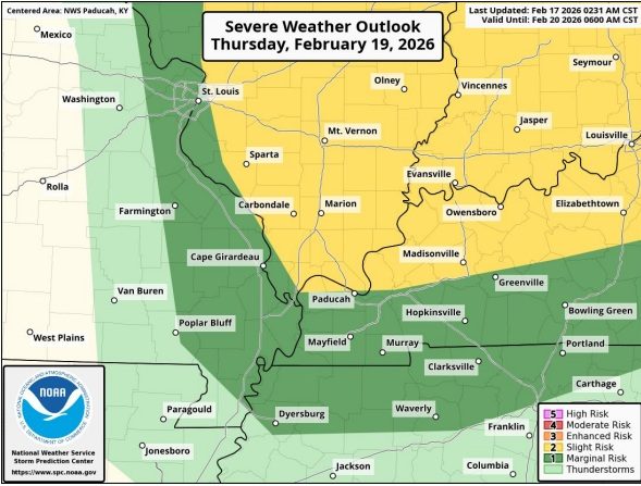
The National Weather Service continues to monitor the threat of severe weather on Thursday, with western Kentucky listed in the slight and marginal risk categories.
Lead forecaster Keith Cooley says warm weather and high winds will be the main factors as the system moves through.
Wind shear is the rapid change in wind speed and direction over a short distance. Strong vertical wind shear organizes thunderstorms, allowing them to become long-lasting supercells.
Cooley says the area of western Kentucky along and north of I-69, formerly the Western Kentucky Parkway, has a slight risk of severe weather, which also includes southern Illinois and southern Indiana.
Areas south of the interstate are in the marginal risk range, which also includes northern Tennessee.
Cooley says high winds are the main threat.
Temperatures are expected in the upper 60s on Wednesday and the low 70s on Thursday.
The storm is not expected to be a major rainmaker, with a maximum of about half an inch in most places.